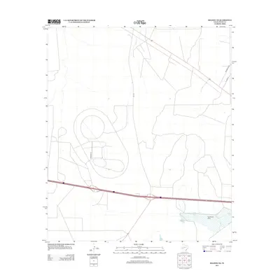
2012 Map of Belding NE
USGS Topo · Published 2012About this map
Leon Springs and the expansive waters of Lake Leon dominate the southeastern landscape of this Pecos County quadrangle. This area of West Texas is defined by its drainage systems, with Acebuche Draw and Courtney Creek carving paths through the arid terrain. The map reveals a specialized infrastructure, most notably the circular tracks and complex road networks accessed via Firestone Road, indicating industrial or automotive testing facilities. Transport corridors such as Fm-1776 and Interstate 10 intersect the region, while secondary routes like Greasewood Road and W Gomez Road provide access to the outlying desert reaches. The juxtaposition of significant water features against high-tech land use makes this a unique study of modern land management in the Texas backcountry.
Find a feature on this map
8 named features on this map. Tap any name to fly to it.
Don’t see what you’re looking for? This feature index may not catch every label — zoom into the map to look around manually.
Map Details
Editions of this 2012 Belding NE Map
This is the sole edition of this map. No revisions or reprints were ever made.
Other maps of this area

1921 · Fort Stockton
USGS Topo · 1:62,500

1923 · Fort Stockton
USGS Topo · 1:62,500

1928 · Comanche Spring
USGS Topo · 1:125,000

1929 · Hovey
USGS Topo · 1:125,000

1931 · Barstow
USGS Topo · 1:125,000

1954 · Pecos
USGS Topo · 1:250,000

1954 · Fort Stockton
USGS Topo · 1:250,000

1957 · Pecos
USGS Topo · 1:250,000

1958 · Fort Stockton
USGS Topo · 1:250,000

1970 · Belding SW
USGS Topo · 1:24,000