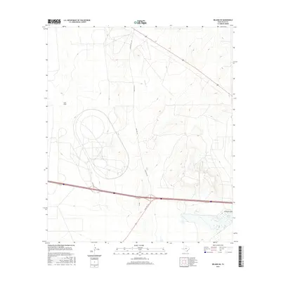
2016 Map of Belding NE
USGS Topo · Published 2016About this map
Lake Léon and the surrounding basin of Léon Springs anchor the southeastern corner of this West Texas landscape. The terrain is defined by broad ephemeral drainages, including Cato Draw in the west and Acebuche Draw near the lake, illustrating the natural water catchment patterns of the Chihuahuan Desert. The map reveals a high-desert environment where infrastructure and land use are shaped by the availability of water and the orientation of historic ranching corridors. Transport through the region centers on the intersection of the I 10 Svc Rd and Cr 4839, with Ranch Rd 1776 cutting a straight line across the northern plateau. The inclusion of Firestone Rd suggests industrial or testing activity in an area otherwise characterized by vast stretches of open rangeland and subtle elevation shifts.
Find a feature on this map
9 named features on this map. Tap any name to fly to it.
Don’t see what you’re looking for? This feature index may not catch every label — zoom into the map to look around manually.
Map Details
Editions of this 2016 Belding NE Map
This is the sole edition of this map. No revisions or reprints were ever made.
Other maps of this area

1921 · Fort Stockton
USGS Topo · 1:62,500

1923 · Fort Stockton
USGS Topo · 1:62,500

1928 · Comanche Spring
USGS Topo · 1:125,000

1929 · Hovey
USGS Topo · 1:125,000

1931 · Barstow
USGS Topo · 1:125,000

1954 · Pecos
USGS Topo · 1:250,000

1954 · Fort Stockton
USGS Topo · 1:250,000

1957 · Pecos
USGS Topo · 1:250,000

1958 · Fort Stockton
USGS Topo · 1:250,000

1970 · Belding SW
USGS Topo · 1:24,000