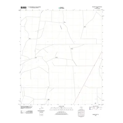
2010 Map of Belding SW
USGS Topo · Published 2010About this map
Kennedy Ranch and the Smith Place anchor this 2010 topographic record of the arid West Texas landscape. The region's dependency on groundwater is clearly evident through the distribution of several named water sources, including the Liano Windmill, Brahma Windmill, and Fortyfoot Windmill. These markers, along with the Bond Windmill and Tanquary Windmill, trace the livestock and ranching infrastructure necessary to survive in this portion of Pecos County.
Find a feature on this map
10 named features on this map. Tap any name to fly to it.
Don’t see what you’re looking for? This feature index may not catch every label — zoom into the map to look around manually.
Map Details
Editions of this 2010 Belding SW Map
This is the sole edition of this map. No revisions or reprints were ever made.
Other maps of this area

1929 · Hovey
USGS Topo · 1:125,000

1954 · Fort Stockton
USGS Topo · 1:250,000

1958 · Fort Stockton
USGS Topo · 1:250,000

1970 · Belding SW
USGS Topo · 1:24,000

1970 · Tucker Hill
USGS Topo · 1:24,000

1970 · Deep Well Ranch SE
USGS Topo · 1:24,000

1970 · Belding NW
USGS Topo · 1:24,000
1970 · Belding NE
USGS Topo · 1:24,000
1970 · Belding
USGS Topo · 1:24,000

1973 · Fort Stockton
USGS Topo · 1:250,000