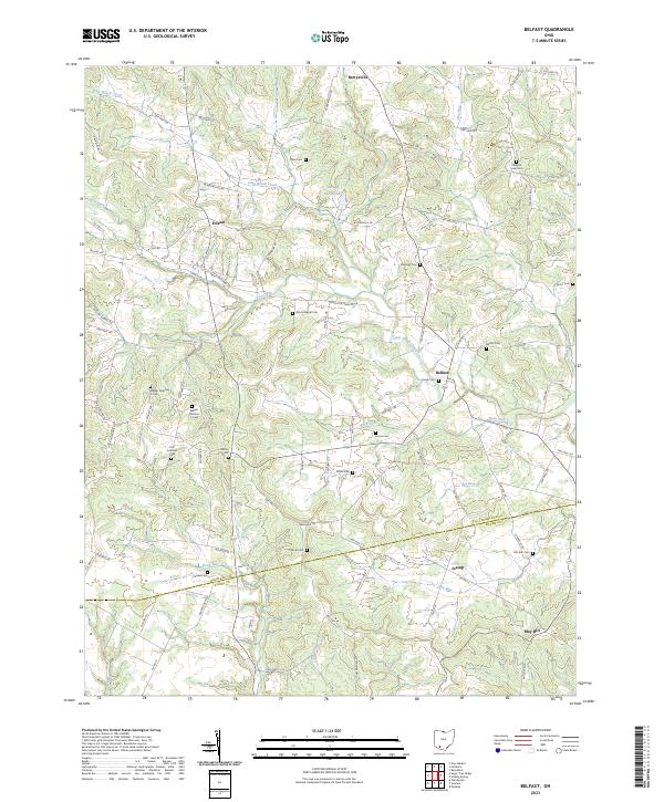
2023 Map of Belfast
USGS Topo · Published 2023About this map
The boundary between Highland and Adams Counties divides a landscape defined by the winding course of Ohio Brush Creek. This region is characterized by small rural settlements such as Belfast and Berrysville, connected by a complex web of township highways and local roads like W Berrysville Rd and Peach Orchard Rd. The concentration of family-named cemeteries, including Walker Number 1 Cem, Walker Number 2 Cem, and Haigh Cem, suggests a long-standing genealogical footprint in the area.
Find a feature on this map
92 named features on this map. Tap any name to fly to it.
Don’t see what you’re looking for? This feature index may not catch every label — zoom into the map to look around manually.
Map Details
Editions of this 2023 Belfast Map
This is the sole edition of this map. No revisions or reprints were ever made.
Other maps of this area

1915 · Bainbridge
USGS Topo · 1:48,000

1916 · Peebles
USGS Topo · 1:62,500

1917 · Bainbridge
USGS Topo · 1:62,500

1917 · Hillsboro
USGS Topo · 1:62,500

1918 · Peebles
USGS Topo · 1:62,500

1918 · Seaman
USGS Topo · 1:62,500

1944 · Hillsboro
USGS Topo · 1:62,500

1947 · Columbus
USGS Topo · 1:250,000

1957 · Huntington
USGS Topo · 1:250,000

1960 · Huntington
USGS Topo · 1:250,000