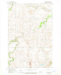
1962 Map of Belfield SE
USGS Topo · Published 1981About this map
The Northern Pacific railroad cuts across the northern reaches of this Stark County landscape, paralleling the course of the Heart River. In the early 1960s, this area south of Belfield was characterized by the winding drainage systems of Norwegian Creek and the South Branch Heart River, which carve through the high prairie. The southern portion of the quadrangle is defined by the distinctive terrain of the Little Badlands, where the elevation drops into a more complex network of draws and ridges around Bull Creek.
Find a feature on this map
12 named features on this map. Tap any name to fly to it.
Don’t see what you’re looking for? This feature index may not catch every label — zoom into the map to look around manually.
Map Details
Editions of this 1962 Belfield SE Map
2 editions found
Other maps of this area

1953 · Dickinson
USGS Topo · 1:250,000

1957 · Dickinson
USGS Topo · 1:250,000

1961 · Daglum
USGS Topo · 1:62,500

1962 · Belfield NE
USGS Topo · 1:24,000

1962 · Belfield SW
USGS Topo · 1:24,000

1962 · Belfield
USGS Topo · 1:24,000

1962 · Belfield SE
USGS Topo · 1:24,000

1973 · New Hradec South
USGS Topo · 1:24,000

1973 · New England NW
USGS Topo · 1:24,000
1973 · South Heart
USGS Topo · 1:24,000