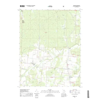
2017 Map of Belgrade
USGS Topo · Published 2017About this map
The Big River winds through the heart of Washington County, anchoring a landscape defined by the foothills of the Saint Francois Mountains. This 2017 study illustrates the rural character of the eastern Missouri Ozarks, centered on the historic settlements of Belgrade and Caledonia. The topography is marked by significant rises such as Kitchell Hill and Aker Hill, while the drainage network includes the Middle Fork Fourche a Renault and Furnace Creek.
Find a feature on this map
68 named features on this map. Tap any name to fly to it.
Don’t see what you’re looking for? This feature index may not catch every label — zoom into the map to look around manually.
Map Details
Editions of this 2017 Belgrade Map
This is the sole edition of this map. No revisions or reprints were ever made.
Other maps of this area

1905 · Bonneterre
USGS Topo · 1:62,500

1906 · Potosi
USGS Topo · 1:62,500

1924 · Edgehill
USGS Topo · 1:62,500

1926 · Edgehill
USGS Topo · 1:62,500

1937 · Ironton
USGS Topo · 1:48,000

1945 · Ironton
USGS Topo · 1:62,500

1946 · Ironton
USGS Topo · 1:62,500

1949 · Rolla
USGS Topo · 1:250,000

1953 · Ironton
USGS Topo · 1:62,500

1953 · Rolla
USGS Topo · 1:250,000