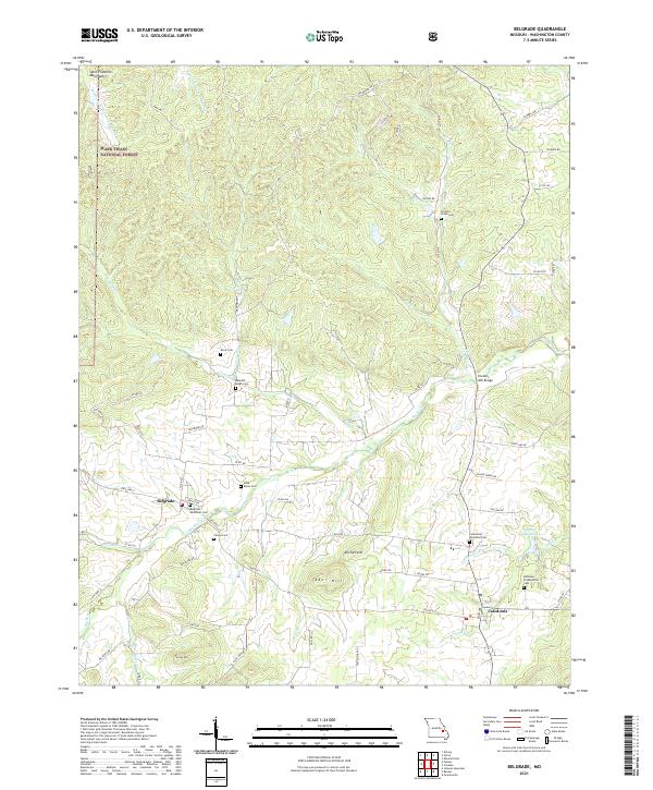
2021 Map of Belgrade
USGS Topo · Published 2021About this map
Belgrade and Caledonia serve as the primary hubs in this section of Missouri, where the foothills of the Saint Francois Mountains meet the fertile valleys of the Big River. The landscape is defined by its deep genealogical roots, visible through a dense concentration of family and community burial grounds such as Bennett Bryan Cem, Jane Bryan Cem, and Carson Cem. These sites, alongside the Bellevue Presbyterian Cem and Caledonia Methodist Cem, anchor the history of early American settlement in Washington County. In the northwest, the Mark Twain National Forest dominates the rugged heights, while the lower elevations are marked by historical crossings like Hunters Mill Bridge over the Big River. The network of local routes, including Old Rte C and Big River RD, traces the established paths between these early centers of trade and faith.
Find a feature on this map
68 named features on this map. Tap any name to fly to it.
Don’t see what you’re looking for? This feature index may not catch every label — zoom into the map to look around manually.
Map Details
Editions of this 2021 Belgrade Map
This is the sole edition of this map. No revisions or reprints were ever made.
Other maps of this area

1905 · Bonneterre
USGS Topo · 1:62,500

1906 · Potosi
USGS Topo · 1:62,500

1924 · Edgehill
USGS Topo · 1:62,500

1926 · Edgehill
USGS Topo · 1:62,500

1937 · Ironton
USGS Topo · 1:48,000

1945 · Ironton
USGS Topo · 1:62,500

1946 · Ironton
USGS Topo · 1:62,500

1949 · Rolla
USGS Topo · 1:250,000

1953 · Ironton
USGS Topo · 1:62,500

1953 · Rolla
USGS Topo · 1:250,000