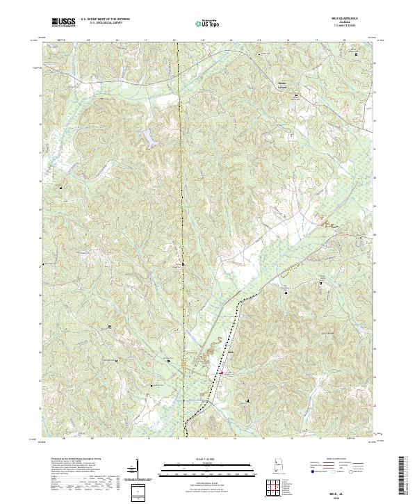
2024 Map of Belk
USGS Topo · Published 2024About this map
Luxapallila Creek winds through the heart of this landscape, carving a valley that separates the rolling heights of Scareum Mtn from the surrounding lowlands. The area is defined by a dense network of country roads like Harkins Rd and Fowler Loop, connecting the rural settlements of Mount Vernon and Covin. This territory, straddling the border of Lamar and Fayette counties, contains a high concentration of generational burial grounds. From Wesley Chapel Cem and Bethabra Cem to New Friendship Cem, these sites are central to the region's genealogy, often positioned near local landmarks like Hopson Lake or the headwaters of Beaver Creek. The map documents a landscape where traditional small-town centers and family-named landmarks endure alongside natural features like Hells Creek and Wiggins Creek.
Find a feature on this map
99 named features on this map. Tap any name to fly to it.
Don’t see what you’re looking for? This feature index may not catch every label — zoom into the map to look around manually.
Map Details
Editions of this 2024 Belk Map
This is the sole edition of this map. No revisions or reprints were ever made.
Other maps of this area

1953 · Birmingham
USGS Topo · 1:250,000

1953 · West Point
USGS Topo · 1:250,000

1956 · Birmingham
USGS Topo · 1:250,000

1957 · Birmingham
USGS Topo · 1:250,000

1958 · West Point
USGS Topo · 1:250,000

1963 · West Point
USGS Topo · 1:250,000

1967 · Winfield SE
USGS Topo · 1:24,000

1967 · Newtonville
USGS Topo · 1:24,000

1967 · Hightogy
USGS Topo · 1:24,000

1967 · Kennedy
USGS Topo · 1:24,000