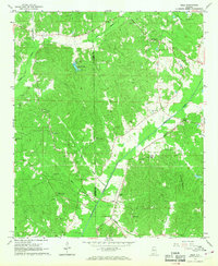
1967 Map of Belk
USGS Topo · Published 1968About this map
Luxapallila Creek carves a central path through this section of the Alabama hill country, defining the settlement patterns of Belk and Covin in the late 1960s. The Southern railroad line runs parallel to the creek, serving as a primary industrial artery for the region's timber and transit needs. The landscape is dotted with small family and community anchors, such as the Covin Sch New Friendship Ch and Wesley Chapel, which reflect the area's rural social fabric.
Find a feature on this map
32 named features on this map. Tap any name to fly to it.
Don’t see what you’re looking for? This feature index may not catch every label — zoom into the map to look around manually.
Map Details
Editions of this 1967 Belk Map
This is the sole edition of this map. No revisions or reprints were ever made.
Other maps of this area

1953 · Birmingham
USGS Topo · 1:250,000

1953 · West Point
USGS Topo · 1:250,000

1956 · Birmingham
USGS Topo · 1:250,000

1957 · Birmingham
USGS Topo · 1:250,000

1958 · West Point
USGS Topo · 1:250,000

1963 · West Point
USGS Topo · 1:250,000

1967 · Winfield SE
USGS Topo · 1:24,000

1967 · Newtonville
USGS Topo · 1:24,000

1967 · Hightogy
USGS Topo · 1:24,000

1967 · Kennedy
USGS Topo · 1:24,000