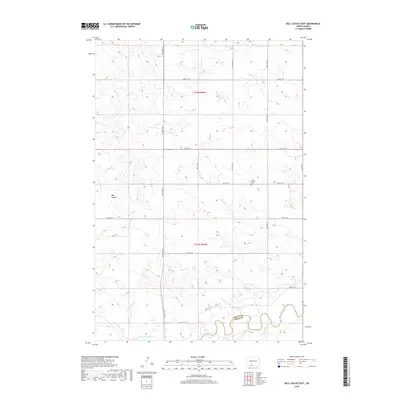
2018 Map of Bell Coulee East
USGS Topo · Published 2018About this map
The Cannonball River meanders across the southern portion of this landscape, marking the boundary where Grant and Sioux counties meet. This prairie terrain is defined by the drainage patterns of Bell Coulee and Leaf-on-the-Hill Creek, which carve through the high plains. A grid of rural section-line roads, including 82nd St SW and 89th St SW, provides the primary structure for the remote agricultural district.
Find a feature on this map
14 named features on this map. Tap any name to fly to it.
Don’t see what you’re looking for? This feature index may not catch every label — zoom into the map to look around manually.
Map Details
Editions of this 2018 Bell Coulee East Map
This is the sole edition of this map. No revisions or reprints were ever made.
Other maps of this area

1954 · Bismarck
USGS Topo · 1:250,000

1958 · Bismarck
USGS Topo · 1:250,000

1971 · Lookout Butte
USGS Topo · 1:24,000

1971 · Shields SW
USGS Topo · 1:24,000

1971 · Shields
USGS Topo · 1:24,000

1971 · Lookout Butte SE
USGS Topo · 1:24,000

1980 · Brisbane
USGS Topo · 1:24,000

1980 · Bell Coulee West
USGS Topo · 1:24,000

1980 · Freda
USGS Topo · 1:24,000

1980 · Bell Coulee East
USGS Topo · 1:24,000