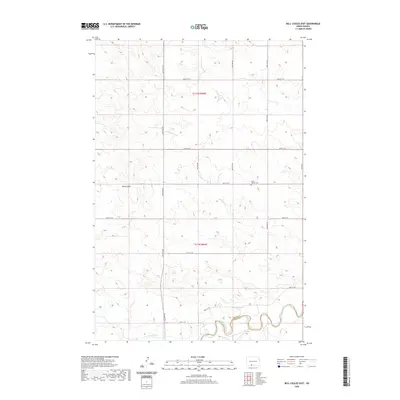
2020 Map of Bell Coulee East
USGS Topo · Published 2020About this map
The Cannonball River snakes through the southern reaches of this landscape, forming a natural boundary near the Grant Co Sioux Co line. This rural North Dakota terrain is defined by its drainage patterns, with Bell Coulee cutting through the western sections. The map reveals a highly structured grid of section lines and secondary roads, such as 82nd St SW and 46th Ave SW, which facilitate movement through the agricultural territory. A significant landmark for local history and genealogy is Saint Gabriel Cem, located along 85th St SW. The area's topography is marked by distinctive rises, including the curiously named Leaf on the Hill overlooking the river valley, providing insight into the traditional nomenclature of this prairie region.
Find a feature on this map
20 named features on this map. Tap any name to fly to it.
Don’t see what you’re looking for? This feature index may not catch every label — zoom into the map to look around manually.
Map Details
Editions of this 2020 Bell Coulee East Map
This is the sole edition of this map. No revisions or reprints were ever made.
Other maps of this area

1954 · Bismarck
USGS Topo · 1:250,000

1958 · Bismarck
USGS Topo · 1:250,000

1971 · Lookout Butte
USGS Topo · 1:24,000

1971 · Shields SW
USGS Topo · 1:24,000

1971 · Shields
USGS Topo · 1:24,000

1971 · Lookout Butte SE
USGS Topo · 1:24,000

1980 · Brisbane
USGS Topo · 1:24,000

1980 · Bell Coulee West
USGS Topo · 1:24,000

1980 · Freda
USGS Topo · 1:24,000

1980 · Bell Coulee East
USGS Topo · 1:24,000