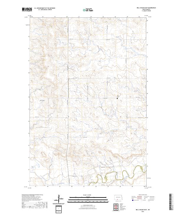
2024 Map of Bell Coulee East
USGS Topo · Published 2024About this map
The Cannonball River winds across the southern reaches of this landscape, marking the border where Grant County meets Sioux County. This prairie terrain is defined by a series of drainage systems, most notably the seasonal Bell Coulee in the northwest and the descriptive Leaf on the Hill Creek that feeds into the river valley. The map documents a sparsely populated rural landscape structured by a precise grid of local roads, such as 46th Ave SW and 86th St SW. A single point of community history, Saint Gabriel Cem, stands near the intersection of 85th St SW and 44th Ave SW, serving as a primary landmark for genealogists tracing early families in this portion of North Dakota.
Find a feature on this map
19 named features on this map. Tap any name to fly to it.
Don’t see what you’re looking for? This feature index may not catch every label — zoom into the map to look around manually.
Map Details
Editions of this 2024 Bell Coulee East Map
This is the sole edition of this map. No revisions or reprints were ever made.
Other maps of this area

1954 · Bismarck
USGS Topo · 1:250,000

1958 · Bismarck
USGS Topo · 1:250,000

1971 · Lookout Butte
USGS Topo · 1:24,000

1971 · Shields SW
USGS Topo · 1:24,000

1971 · Shields
USGS Topo · 1:24,000

1971 · Lookout Butte SE
USGS Topo · 1:24,000

1980 · Brisbane
USGS Topo · 1:24,000

1980 · Bell Coulee West
USGS Topo · 1:24,000

1980 · Freda
USGS Topo · 1:24,000

1980 · Bell Coulee East
USGS Topo · 1:24,000