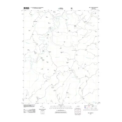
2010 Map of Bell Farm
USGS Topo · Published 2010About this map
Rockybranch and the nearby settlement of Griffin anchor the northern landscape of this region, defined by deep hollows and narrow ridges within the Cumberland Plateau. Family history is etched into the terrain through numerous burial grounds, including the Barrier Cemetery, Criswell Cemetery, and Phillips Cemetery. The geography is notably steep, characterized by prominent landmarks like The Pilot, Chimney Rock, and the high point at Watts Mountain.
Find a feature on this map
83 named features on this map. Tap any name to fly to it.
Don’t see what you’re looking for? This feature index may not catch every label — zoom into the map to look around manually.
Map Details
Editions of this 2010 Bell Farm Map
This is the sole edition of this map. No revisions or reprints were ever made.
Other maps of this area

1911 · Monticello
USGS Topo · 1:62,500

1914 · Monticello
USGS Topo · 1:62,500

1932 · Burnside
USGS Topo · 1:62,500

1934 · Barthell
USGS Topo · 1:62,500

1934 · Pall Mall
USGS Topo · 1:62,500

1953 · Monticello
USGS Topo · 1:24,000

1954 · Parmleysville
USGS Topo · 1:24,000

1954 · Coopersville
USGS Topo · 1:24,000
1954 · Nevelsville
USGS Topo · 1:24,000
1954 · Barthell
USGS Topo · 1:24,000