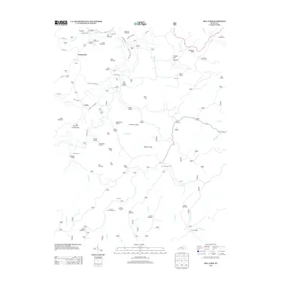
2013 Map of Bell Farm
USGS Topo · Published 2013About this map
Bell Farm and the settlement of Griffin anchor this landscape of the Daniel Boone National Forest region in the early twenty-first century. The map reveals a high density of family-named landmarks and cemeteries, such as the Rigney Gregory Cem and Denny Farm Cem, indicating generations of deep-rooted kinship in the hollows. Distinctive river crossings like Bawley Ford and Denney Ford suggest the enduring importance of traditional water access points in an area defined by steep terrain and narrow valleys. Significant geological features, including The Mill Cliff and The Pilot, provide a clear picture of the limestone and sandstone outcrops that shape the local drainage patterns of Johnson Fork and Wolf Cr. The presence of the Bell Farm Horse Camp and Great Meadow Campground reflects the shift toward recreational land use while preserving the names of the original farming families.
Find a feature on this map
100 named features on this map. Tap any name to fly to it.
Don’t see what you’re looking for? This feature index may not catch every label — zoom into the map to look around manually.
Map Details
Editions of this 2013 Bell Farm Map
This is the sole edition of this map. No revisions or reprints were ever made.
Other maps of this area

1911 · Monticello
USGS Topo · 1:62,500

1914 · Monticello
USGS Topo · 1:62,500

1932 · Burnside
USGS Topo · 1:62,500

1934 · Barthell
USGS Topo · 1:62,500

1934 · Pall Mall
USGS Topo · 1:62,500

1953 · Monticello
USGS Topo · 1:24,000

1954 · Parmleysville
USGS Topo · 1:24,000

1954 · Coopersville
USGS Topo · 1:24,000
1954 · Nevelsville
USGS Topo · 1:24,000
1954 · Barthell
USGS Topo · 1:24,000