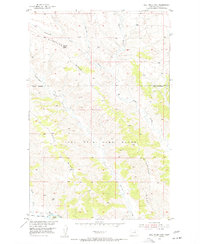
1954 Map of Bell Ridge East
USGS Topo · Published 1956About this map
Fort Peck Game Range dominates the central landscape of this Phillips County territory, where the complex drainage systems of Little Cottonwood Creek, Rock Creek, and Siparyann Creek carve through the high plains toward the southern boundary. Along the southern edge, the Missouri River defines the local geography, featuring Jones Island and the adjacent Bell Bottoms. The terrain is characterized by the prominent elevation of Square Butte and the stretching landform of Bell Ridge. This 1950s survey captures the area as part of the Missouri River Basin development program, illustrating a sparsely settled environment focused on conservation and water management. The absence of established towns highlights the region's character as a protected wilderness and ranching frontier, with the Duval Creek drainage further detailing the intricate topography of the Montana breaks.
Find a feature on this map
11 named features on this map. Tap any name to fly to it.
Don’t see what you’re looking for? This feature index may not catch every label — zoom into the map to look around manually.
Map Details
Editions of this 1954 Bell Ridge East Map
2 editions found
Other maps of this area

1943 · Landusky
USGS Topo · 1:125,000

1954 · Bell Ridge East
USGS Topo · 1:24,000

1954 · Hessler Ridge
USGS Topo · 1:24,000

1954 · Carter Coulee
USGS Topo · 1:24,000

1954 · Bell Ridge West
USGS Topo · 1:24,000

1954 · Lewistown
USGS Topo · 1:250,000

1959 · Lewistown
USGS Topo · 1:250,000

1971 · Robinson School
USGS Topo · 1:24,000

1971 · Hays SE
USGS Topo · 1:24,000
1971 · D Y Junction
USGS Topo · 1:24,000