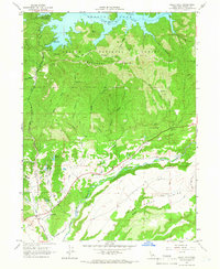
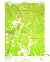
1965 Map of Bella Vista
USGS Topo · Published 1966About this map
Bella Vista serves as the primary settlement hub in this 1960s study of the Shasta County landscape, situated where the terrain transitions from the alluvial flats of Swede Plains into the rising timber of the Shasta National Forest. The northern reach of the map is dominated by the sprawling waters of Shasta Lake and the Pit River, punctuated by recreational sites like Mariners Point Campground and Rend Island Campground. The rugged interior is defined by Backbone Ridge, which separates numerous drainage systems including Clikapudi Creek and Dry Creek. To the south, the water network becomes more intricate near Mirror Lake and Elks Lake as Little Cow Creek and Cow Creek converge. These waterways were essential to the early development of the region, supporting ranching and local transit along routes like Deschutes Road and various jeep trails that navigate the canyons.
Find a feature on this map
45 named features on this map. Tap any name to fly to it.
Don’t see what you’re looking for? This feature index may not catch every label — zoom into the map to look around manually.
Map Details
Editions of this 1965 Bella Vista Map
3 editions found
Other maps of this area

1890 · Red Bluff
USGS Topo · 1:250,000

1894 · Red Bluff
USGS Topo · 1:250,000

1901 · Redding
USGS Topo · 1:125,000

1944 · Redding
USGS Topo · 1:62,500

1946 · Lamoine
USGS Topo · 1:62,500

1946 · Redding
USGS Topo · 1:62,500

1949 · Bollibokka Mtn
USGS Topo · 1:62,500

1953 · Millville
USGS Topo · 1:62,500
1957 · Enterprise
USGS Topo · 1:24,000
1957 · Project City
USGS Topo · 1:24,000