
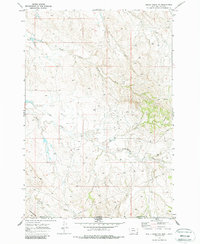
1970 Map of Belle Creek SW
USGS Topo · Published 1973About this map
The high plains along the Montana Wyoming border come into sharp focus in this topographic study, where the landscape transitions across the Powder River and Campbell County lines. This era of land use is defined by a sparse but systematic network of energy infrastructure, as evidenced by numerous Oil Wells, a significant Pipeline, and various Drill Holes dotting the terrain.
Find a feature on this map
10 named features on this map. Tap any name to fly to it.
Don’t see what you’re looking for? This feature index may not catch every label — zoom into the map to look around manually.
Map Details
Editions of this 1970 Belle Creek SW Map
2 editions found
Other maps of this area

1954 · Ekalaka
USGS Topo · 1:250,000

1954 · Gillette
USGS Topo · 1:250,000

1955 · Gillette
USGS Topo · 1:250,000

1956 · Ekalaka
USGS Topo · 1:250,000

1958 · Gillette
USGS Topo · 1:250,000

1958 · Ekalaka
USGS Topo · 1:250,000

1962 · Gillette
USGS Topo · 1:250,000

1965 · Ekalaka
USGS Topo · 1:250,000

1970 · Pine Creek
USGS Topo · 1:24,000

1970 · Sanburn Reservoir
USGS Topo · 1:24,000