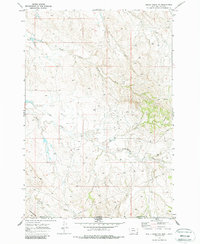
1970 Map of Belle Creek SW
USGS Topo · Published 1986About this map
Ranch Creek and the South Fork Wright Creek define the drainage patterns of this borderland region where the High Plains of Montana meet Wyoming. Mapped just after the 1960s, the landscape shows a clear focus on energy extraction, evidenced by numerous Oil Well and Drill Hole locations scattered across the townships. The Ranch Creek Cem stands as a solitary marker of local family history near the creek's bend, while the Prairie Dog Hills rise in the southwestern corner. This 1970 field check documents the industrial infrastructure of the era, including a major Pipeline cutting diagonally across the prairie, reflecting the mid-century development of the Powder River Basin oil fields.
Find a feature on this map
10 named features on this map. Tap any name to fly to it.
Don’t see what you’re looking for? This feature index may not catch every label — zoom into the map to look around manually.
Map Details
Editions of this 1970 Belle Creek SW Map
2 editions found

Other maps of this area

1954 · Ekalaka
USGS Topo · 1:250,000

1954 · Gillette
USGS Topo · 1:250,000

1955 · Gillette
USGS Topo · 1:250,000

1956 · Ekalaka
USGS Topo · 1:250,000

1958 · Gillette
USGS Topo · 1:250,000

1958 · Ekalaka
USGS Topo · 1:250,000

1962 · Gillette
USGS Topo · 1:250,000

1965 · Ekalaka
USGS Topo · 1:250,000

1970 · Pine Creek
USGS Topo · 1:24,000

1970 · Sanburn Reservoir
USGS Topo · 1:24,000