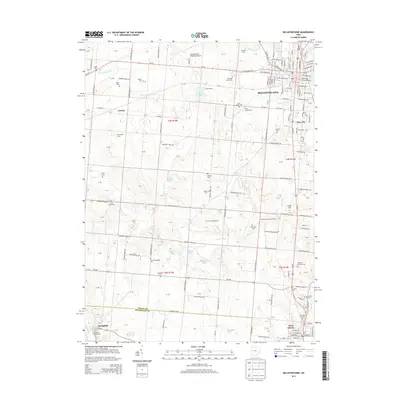
2013 Map of Bellefontaine
USGS Topo · Published 2013About this map
Bellefontaine serves as the focal point of this western Ohio landscape, where the urban grid of the county seat meets a dense network of township roads. The map captures a transition from the structured streets of Iron City and the northern outskirts of West Liberty into an agricultural expanse dotted with family-run landmarks like Bickham Farm and Sunnyside Farm. Water is a defining element throughout, from the headwaters of McKees Cr and Stony Cr to larger bodies like Silver Lake and Newell Lake. A high density of rural burial grounds, including the New Philadelphia Cem, Alexander Cem, and Parish Cem, offers significant detail for genealogical research. The southern portion of the sheet follows the boundary between Logan and Champaign counties, tracing the path of the Mad River through the village of Springhills.
Find a feature on this map
180 named features on this map. Tap any name to fly to it.
Don’t see what you’re looking for? This feature index may not catch every label — zoom into the map to look around manually.
Map Details
Editions of this 2013 Bellefontaine Map
This is the sole edition of this map. No revisions or reprints were ever made.
Other maps of this area

1913 · Bellefontaine
USGS Topo · 1:48,000

1913 · East Liberty
USGS Topo · 1:62,500

1914 · St. Paris
USGS Topo · 1:62,500

1914 · Mechanicsburg
USGS Topo · 1:62,500

1915 · Bellefontaine
USGS Topo · 1:62,500

1915 · East Liberty
USGS Topo · 1:62,500

1916 · Mechanicsburg
USGS Topo · 1:62,500

1916 · St. Paris
USGS Topo · 1:62,500

1944 · East Liberty
USGS Topo · 1:62,500

1944 · Mechanicsburg
USGS Topo · 1:62,500