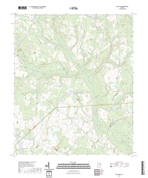
2024 Map of Bellevue
USGS Topo · Published 2024About this map
Buckhead Creek and its many tributaries, including Chew Mill Creek and Steiner Branch, define the low-lying landscape of the Burke and Jenkins county line. This contemporary survey of the Bellevue area illustrates a rural environment shaped by large landholdings and water resources, evidenced by Knight Lake and Carswell Lake. For those tracing family history, the map provides precise locations for several local burial grounds, such as Fairhaven Cem and Carswell Grove Baptist Church Cem. The road network is largely comprised of routes named for local families and plantations, such as Di Lane Plantation Rd, Porter Rd, and Caswell Rd, reflecting a legacy of generational land ownership. The presence of Big Buckhead Cem near the southern boundary serves as a quiet marker of the region’s long-standing community centers along the creeks.
Find a feature on this map
45 named features on this map. Tap any name to fly to it.
Don’t see what you’re looking for? This feature index may not catch every label — zoom into the map to look around manually.
Map Details
Editions of this 2024 Bellevue Map
This is the sole edition of this map. No revisions or reprints were ever made.
Other maps of this area

1919 · Gough
USGS Topo · 1:62,500

1920 · Millen
USGS Topo · 1:62,500

1920 · Greens Cut
USGS Topo · 1:62,500

1943 · Greens Cut
USGS Topo · 1:62,500

1943 · Millen
USGS Topo · 1:62,500

1943 · Augusta East
USGS Topo · 1:125,000

1943 · Millen
USGS Topo · 1:125,000

1947 · Savannah
USGS Topo · 1:250,000

1948 · Savannah
USGS Topo · 1:250,000

1948 · Gough
USGS Topo · 1:62,500