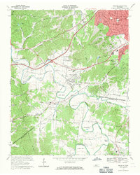
1968 Map of Bellevue
USGS Topo · Published 1971About this map
The Harpeth River meanders through this 1968 landscape, creating deep alluvial bends such as Hutton Bend, Beech Bend, and Sawyer Bend. This era shows the suburban expansion of Nashville reaching toward Bellevue and West Meade, where new residential developments began to climb the slopes of Ninemile Hill and tuck into Jocelyn Hollow. Despite this growth, the area retains a strong rural institutional identity, marked by numerous local landmarks including Gower Sch, St Davids Ch, and the Morton Mill site near the river.
Find a feature on this map
64 named features on this map. Tap any name to fly to it.
Don’t see what you’re looking for? This feature index may not catch every label — zoom into the map to look around manually.
Map Details
Editions of this 1968 Bellevue Map
4 editions found
Other maps of this area

1901 · Colombia
USGS Topo · 1:125,000

1903 · Nashville
USGS Topo · 1:125,000

1909 · Franklin
USGS Topo · 1:62,500

1930 · White Bluff
USGS Topo · 1:62,500

1932 · Nashville
USGS Topo · 1:62,500

1933 · White Bluff
USGS Topo · 1:62,500

1946 · Leipers Fork
USGS Topo · 1:24,000

1949 · Leipers Fork
USGS Topo · 1:24,000

1949 · Franklin
USGS Topo · 1:24,000

1951 · Fairview
USGS Topo · 1:24,000