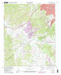
1968 Map of Bellevue
USGS Topo · Published 1988About this map
The Harpeth River carves a winding course through this landscape, creating a series of dramatic geographic loops including Hows Bend, Hicks Bend, and Sawyer Bend. By the late 1960s, the rural character of this area southwest of Nashville was beginning to shift, as seen in the suburban expansion of West Meade and Forest Hills. Despite this growth, the map preserves the earlier village-scale footprints of Bellevue and Pasquo, along with numerous family and community landmarks like Gower Sch and Central Zion Ch.
Find a feature on this map
71 named features on this map. Tap any name to fly to it.
Don’t see what you’re looking for? This feature index may not catch every label — zoom into the map to look around manually.
Map Details
Editions of this 1968 Bellevue Map
4 editions found
Other maps of this area

1901 · Colombia
USGS Topo · 1:125,000

1903 · Nashville
USGS Topo · 1:125,000

1909 · Franklin
USGS Topo · 1:62,500

1930 · White Bluff
USGS Topo · 1:62,500

1932 · Nashville
USGS Topo · 1:62,500

1933 · White Bluff
USGS Topo · 1:62,500

1946 · Leipers Fork
USGS Topo · 1:24,000

1949 · Leipers Fork
USGS Topo · 1:24,000

1949 · Franklin
USGS Topo · 1:24,000

1951 · Fairview
USGS Topo · 1:24,000