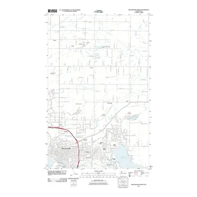
2011 Map of Bellingham North
USGS Topo · Published 2011About this map
Bellingham is shown here during a period of modern expansion, where urban neighborhoods like Roosevelt and Eureka meet the industrial and agricultural heritage of Whatcom County. The landscape is defined by the transition from the city's street grid to the varied terrain of King Mountain and Toad Mountain. Along the shores of Lake Whatcom, the map identifies the Larson Mill and the Washington Bellingham Hatchery, illustrating the ongoing importance of the waterfront. To the north, the terrain flattens into a grid of rural roads and active resource extraction sites, including the Axton Pit East Quarry and Pullar Quarry. Small outlying communities such as Laurel Gardens and Van Wyck are documented along primary corridors like Van Wyck Rd and Ten Mile Rd, while the Mount Baker Post Office serves as a central point for the burgeoning commercial districts near Meridian Village.
Find a feature on this map
76 named features on this map. Tap any name to fly to it.
Don’t see what you’re looking for? This feature index may not catch every label — zoom into the map to look around manually.
Map Details
Editions of this 2011 Bellingham North Map
This is the sole edition of this map. No revisions or reprints were ever made.
Other maps of this area

1906 · Sumas
USGS Topo · 1:62,500

1907 · Blaine
USGS Topo · 1:62,500

1908 · Sumas
USGS Topo · 1:62,500

1918 · Samish Lake
USGS Topo · 1:62,500

1943 · Anacortes
USGS Topo · 1:62,500

1951 · Anacortes
USGS Topo · 1:62,500

1952 · Lake Whatcom
USGS Topo · 1:24,000

1952 · Bertrand Creek
USGS Topo · 1:24,000

1952 · Lynden
USGS Topo · 1:24,000

1952 · Lawrence
USGS Topo · 1:24,000