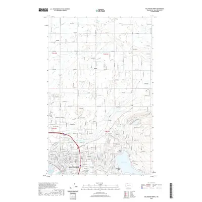
2020 Map of Bellingham North
USGS Topo · Published 2020About this map
Bellingham is anchored by the industrial and civic heart of the city in this 2020 study, where the Whatcom County Courthouse and Civic Field define the urban center. The geography shifts from the coastal Whatcom Creek Waterway and I and J Street Waterway toward the residential and academic expansion at Whatcom Community College. To the east, the landscape rises toward Squalicum Mtn and Toad Mtn, framing the northern reaches of Lake Whatcom at Silver Beach.
Find a feature on this map
123 named features on this map. Tap any name to fly to it.
Don’t see what you’re looking for? This feature index may not catch every label — zoom into the map to look around manually.
Map Details
Editions of this 2020 Bellingham North Map
This is the sole edition of this map. No revisions or reprints were ever made.
Other maps of this area

1906 · Sumas
USGS Topo · 1:62,500

1907 · Blaine
USGS Topo · 1:62,500

1908 · Sumas
USGS Topo · 1:62,500

1918 · Samish Lake
USGS Topo · 1:62,500

1943 · Anacortes
USGS Topo · 1:62,500

1951 · Anacortes
USGS Topo · 1:62,500

1952 · Lake Whatcom
USGS Topo · 1:24,000

1952 · Bertrand Creek
USGS Topo · 1:24,000

1952 · Lynden
USGS Topo · 1:24,000

1952 · Lawrence
USGS Topo · 1:24,000