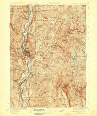
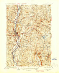
1930 Map of Bellows Falls
USGS Topo · Published 1930About this map
Connecticut River valley life in the late 1920s is defined by the vital rail and road corridors connecting Vermont and New Hampshire. This 1930 edition shows the Boston and Maine RR tracing the river's path, serving industrial and agricultural hubs like Bellows Falls and Charlestown. Social and civic life is anchored by landmarks such as the Dodge Tavern and the Kurn Hattin Home, while the upland terrain is dotted with small neighborhood institutions like the Mira Miner Sch and Holden Hill Sch.
Find a feature on this map
122 named features on this map. Tap any name to fly to it.
Don’t see what you’re looking for? This feature index may not catch every label — zoom into the map to look around manually.
Map Details
Editions of this 1930 Bellows Falls Map
7 editions found

Other maps of this area

1891 · Brattleboro
USGS Topo · 1:62,500

1893 · Brattleboro
USGS Topo · 1:62,500

1898 · Monadnock
USGS Topo · 1:62,500

1898 · Keene
USGS Topo · 1:62,500

1902 · Sunapee
USGS Topo · 1:62,500

1905 · Sunapee
USGS Topo · 1:62,500

1907 · Sunapee
USGS Topo · 1:62,500

1926 · Claremont
USGS Topo · 1:62,500

1927 · Bellows Falls
USGS Topo · 1:48,000

1928 · Ludlow
USGS Topo · 1:48,000