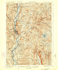
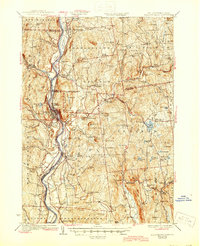
1930 Map of Bellows Falls
USGS Topo · Published 1933About this map
The Connecticut River serves as the central artery for this 1930s survey, marking the border between Vermont and New Hampshire. The industrial and transit hub of Bellows Falls dominates the riverbank, where the Rutland RR and Boston and Maine RR intersect near the falls. This era shows a landscape where small-scale industry and community institutions are still deeply localized, evidenced by the presence of the Mica Mine and its accompanying Mica Mine Sch in the eastern hills.
Find a feature on this map
131 named features on this map. Tap any name to fly to it.
Don’t see what you’re looking for? This feature index may not catch every label — zoom into the map to look around manually.
Map Details
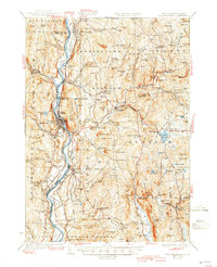
Editions of this 1930 Bellows Falls Map
7 editions found

Other maps of this area

1891 · Brattleboro
USGS Topo · 1:62,500

1893 · Brattleboro
USGS Topo · 1:62,500

1898 · Monadnock
USGS Topo · 1:62,500

1898 · Keene
USGS Topo · 1:62,500

1902 · Sunapee
USGS Topo · 1:62,500

1905 · Sunapee
USGS Topo · 1:62,500

1907 · Sunapee
USGS Topo · 1:62,500

1926 · Claremont
USGS Topo · 1:62,500

1927 · Bellows Falls
USGS Topo · 1:48,000

1928 · Ludlow
USGS Topo · 1:48,000