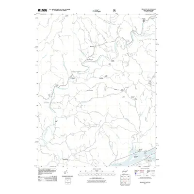
2011 Map of Belmont
USGS Topo · Published 2011About this map
The Ohio River forms the southern boundary of this region, where First Brother Island and Broadback Island sit near the riverbank. This river-centered economy is marked by historic points such as Leonards Landing, Clarks Landing, and Schnaufers Landing. Moving inland from the city of Belmont, the terrain transitions into a dense network of creek valleys and ridges. The Little Muskingum River meanders through the landscape, flanked by small settlements like Moss Run, Sitka, and Gracey.
Find a feature on this map
101 named features on this map. Tap any name to fly to it.
Don’t see what you’re looking for? This feature index may not catch every label — zoom into the map to look around manually.
Map Details
Editions of this 2011 Belmont Map
This is the sole edition of this map. No revisions or reprints were ever made.
Other maps of this area

1903 · Macksburg
USGS Topo · 1:62,500

1904 · Marietta
USGS Topo · 1:62,500

1905 · New Matamoras
USGS Topo · 1:62,500

1905 · Macksburg
USGS Topo · 1:62,500

1906 · Saint Marys
USGS Topo · 1:62,500

1924 · St Marys
USGS Topo · 1:62,500

1924 · New Matamoras
USGS Topo · 1:62,500

1924 · Marietta
USGS Topo · 1:62,500

1926 · New Matamoras
USGS Topo · 1:62,500

1927 · Marietta
USGS Topo · 1:62,500