2015 Map of Belmont
USGS Topo · Published 2015About this map
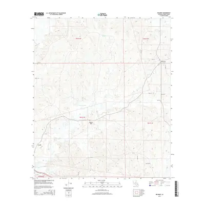
Belmont and Bayou Scie anchor the rural landscape of Sabine Parish in this 2015 U.S. Geological Survey study, where the terrain is defined by a network of local roads and natural drainage systems. The northern reaches are marked by Turpentine Spring and the Lewing Rd corridor, while the central portion is dominated by the winding path of Beaverdam Slough. This modern survey provides precise positioning for local family landmarks and burial sites, including Linn Cem in the northwest and Wofed Cem further east. The southwestern corner shows the outskirts of Zwolle, with the landscape increasingly bisected by routes such as La-1216 and Oosta Rd. The map illustrates a contemporary view of traditional Louisiana back-country, where established names like Lewis Cr and Carson Rd continue to mark the boundaries of local life and movement through the timbered sections of T8N and T9N.
Find a feature on this map
25 named features on this map. Tap any name to fly to it.
Don’t see what you’re looking for? This feature index may not catch every label — zoom into the map to look around manually.
Map Details
Editions of this 2015 Belmont Map
This is the sole edition of this map. No revisions or reprints were ever made.
Other maps of this area

1938 · Hollis Creek
USGS Topo · 1:31,680

1941 · Zwolle
USGS Topo · 1:62,500

1941 · Pelican
USGS Topo · 1:62,500

1942 · Many
USGS Topo · 1:62,500

1943 · Many
USGS Topo · 1:62,500

1943 · Pleasant Hill
USGS Topo · 1:62,500

1944 · Zwolle
USGS Topo · 1:62,500

1944 · Pleasant Hill
USGS Topo · 1:62,500

1947 · Hanna
USGS Topo · 1:62,500

1953 · Alexandria
USGS Topo · 1:250,000