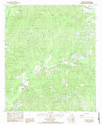
1988 Map of Belmont
USGS Topo · Published 1988About this map
The community of Belmont and the northeastern fringes of Zwolle anchor this 1980s landscape in Sabine Parish, Louisiana. The terrain is defined by a dense drainage network where Bayou San Miguel and San Miguel Creek navigate the lowlands alongside smaller watercourses like White Oak Creek and Sneed Creek. The presence of Turpentine Spring in the northern portion of the sheet suggests a history tied to the local pine industry, while Beaverdam Slough and Brushy Bayou illustrate the typical bottomland features of the region.
Find a feature on this map
14 named features on this map. Tap any name to fly to it.
Don’t see what you’re looking for? This feature index may not catch every label — zoom into the map to look around manually.
Map Details
Editions of this 1988 Belmont Map
This is the sole edition of this map. No revisions or reprints were ever made.
Other maps of this area

1938 · Hollis Creek
USGS Topo · 1:31,680

1941 · Zwolle
USGS Topo · 1:62,500

1941 · Pelican
USGS Topo · 1:62,500

1942 · Many
USGS Topo · 1:62,500

1943 · Many
USGS Topo · 1:62,500

1943 · Pleasant Hill
USGS Topo · 1:62,500

1944 · Zwolle
USGS Topo · 1:62,500

1944 · Pleasant Hill
USGS Topo · 1:62,500

1947 · Hanna
USGS Topo · 1:62,500

1953 · Alexandria
USGS Topo · 1:250,000