
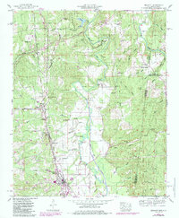
1950 Map of Belmont
USGS Topo · Published 1971About this map
Belmont and Dennis anchor the southern reach of this Tishomingo County landscape, where the Illinois Central Railroad cuts a north-south path through the hilly terrain. The Tennessee Valley Divide snakes through the western portion of the sheet, separating the drainage of Bear Creek from the surrounding creek networks. To the north, the Natchez Trace Parkway was under construction during the 1950 survey, marking a modern transition for this rural area.
Find a feature on this map
55 named features on this map. Tap any name to fly to it.
Don’t see what you’re looking for? This feature index may not catch every label — zoom into the map to look around manually.
Map Details
Editions of this 1950 Belmont Map
2 editions found
Other maps of this area

1935 · Holcut
USGS Topo · 1:24,000

1935 · Pleasant Site
USGS Topo · 1:24,000

1936 · Belmont
USGS Topo · 1:24,000

1936 · Red Bay
USGS Topo · 1:24,000

1936 · Halltown
USGS Topo · 1:24,000

1936 · Bishop
USGS Topo · 1:24,000

1936 · Tishomingo
USGS Topo · 1:24,000

1950 · Paden
USGS Topo · 1:24,000
1950 · Bishop
USGS Topo · 1:24,000
1950 · Tishomingo
USGS Topo · 1:24,000