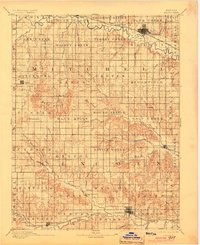
1894 Map of Beloit
USGS Topo · Published 1904About this map
The Solomon River and its multiple forks dominate the northern landscape of Mitchell County, where the growing rail center of Beloit sits at the junction of the Union Pacific Railway and the A. T. & S. F. R. R. Branch lines connect early agricultural hubs like Glen Elder and Solomon Rapids, while the distinctive Great Spirit Spring remains a prominent natural landmark in the northwest. To the south, the terrain transitions into the Blue Hills, a region of intricate drainage patterns defined by Spillman Creek and Salt Creek.
Find a feature on this map
90 named features on this map. Tap any name to fly to it.
Don’t see what you’re looking for? This feature index may not catch every label — zoom into the map to look around manually.
Map Details
Editions of this 1894 Beloit Map
3 editions found
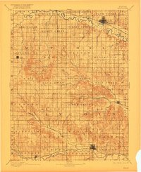
Other maps of this area

1892 · Concordia
USGS Topo · 1:125,000

1892 · Salina
USGS Topo · 1:125,000

1892 · Minneapolis
USGS Topo · 1:125,000

1893 · Smith Center
USGS Topo · 1:125,000

1894 · Ellsworth
USGS Topo · 1:125,000

1894 · Mankato
USGS Topo · 1:125,000

1894 · Beloit
USGS Topo · 1:125,000

1896 · Osborne
USGS Topo · 1:125,000

1896 · Russell
USGS Topo · 1:125,000

1942 · Salina
USGS Topo · 1:125,000