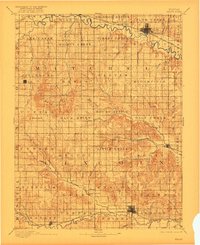
1894 Map of Beloit
USGS Topo · Published 1922About this map
Beloit and Lincoln serve as the primary hubs in this late nineteenth-century survey of the Solomon and Saline River valleys. The landscape is defined by the high, broken ground of the Blue Hills, where features like Willams Butte and Blue Hill rise above the surrounding plains. A notable geological landmark, the Great Spirit Spring, is situated near the northern edge of the map along the Solomon River.
Find a feature on this map
86 named features on this map. Tap any name to fly to it.
Don’t see what you’re looking for? This feature index may not catch every label — zoom into the map to look around manually.
Map Details
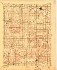
Editions of this 1894 Beloit Map
3 editions found
Other maps of this area

1892 · Concordia
USGS Topo · 1:125,000

1892 · Salina
USGS Topo · 1:125,000

1892 · Minneapolis
USGS Topo · 1:125,000

1893 · Smith Center
USGS Topo · 1:125,000

1894 · Ellsworth
USGS Topo · 1:125,000

1894 · Mankato
USGS Topo · 1:125,000

1894 · Beloit
USGS Topo · 1:125,000

1896 · Osborne
USGS Topo · 1:125,000

1896 · Russell
USGS Topo · 1:125,000

1942 · Salina
USGS Topo · 1:125,000