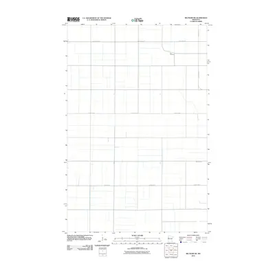
2010 Map of Beltrami SW
USGS Topo · Published 2010About this map
Zion Cemetery stands as a quiet landmark in the northeast quadrant of this rural Polk County landscape. The terrain is defined by a rigorous grid of section lines and gravel roads, including County Hwy-219 and County Hwy-1, which facilitate the region's agricultural layout. A break in this geometric precision occurs where the Sand Hill River meanders across the southern half of the sheet, providing a natural drainage corridor through the prairie. This 2010 survey reflects the enduring structure of Minnesota's Red River Valley farmlands, where road networks like County Hwy-14 and County Hwy-51 connect isolated farmsteads to the broader township. The map is a clean record of rural land management and local cemetery placement at the start of the 21st century.
Find a feature on this map
6 named features on this map. Tap any name to fly to it.
Don’t see what you’re looking for? This feature index may not catch every label — zoom into the map to look around manually.
Map Details
Editions of this 2010 Beltrami SW Map
This is the sole edition of this map. No revisions or reprints were ever made.
Other maps of this area

1918 · Hendrum
USGS Topo · 1:62,500

1919 · Eldred
USGS Topo · 1:62,500

1919 · Beltrami
USGS Topo · 1:62,500

1924 · Ada
USGS Topo · 1:62,500

1952 · Grand Forks
USGS Topo · 1:250,000

1956 · Grand Forks
USGS Topo · 1:250,000

1963 · Shelly
USGS Topo · 1:24,000

1964 · Beltrami
USGS Topo · 1:24,000

1964 · Beltrami SW
USGS Topo · 1:24,000

1964 · Girard
USGS Topo · 1:24,000