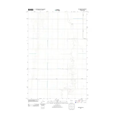
2013 Map of Beltrami SW
USGS Topo · Published 2013About this map
Zion Cem stands as a quiet focal point in this portion of Polk County, where the landscape is defined by an intricate network of engineered drainage systems and the natural course of the Sand Hill River. This 2013 survey illustrates the highly organized agricultural infrastructure of the Red River Valley, characterized by a massive grid of ditches including County Ditch Number One Hundred Nineteen, County Ditch Number Fortysix, and the long span of Judicial Ditch Number Fiftyseven. The map reveals the systematic transformation of the terrain for farming, with section lines and rural routes like Co HWY-1 and Co HWY-14 providing the primary framework for local movement. The presence of County Ditch Number Eightysix and County Ditch Number Seventythree further emphasizes the scale of hydrological management necessary for the region's productivity.
Find a feature on this map
10 named features on this map. Tap any name to fly to it.
Don’t see what you’re looking for? This feature index may not catch every label — zoom into the map to look around manually.
Map Details
Editions of this 2013 Beltrami SW Map
This is the sole edition of this map. No revisions or reprints were ever made.
Other maps of this area

1918 · Hendrum
USGS Topo · 1:62,500

1919 · Eldred
USGS Topo · 1:62,500

1919 · Beltrami
USGS Topo · 1:62,500

1924 · Ada
USGS Topo · 1:62,500

1952 · Grand Forks
USGS Topo · 1:250,000

1956 · Grand Forks
USGS Topo · 1:250,000

1963 · Shelly
USGS Topo · 1:24,000

1964 · Beltrami
USGS Topo · 1:24,000

1964 · Beltrami SW
USGS Topo · 1:24,000

1964 · Girard
USGS Topo · 1:24,000