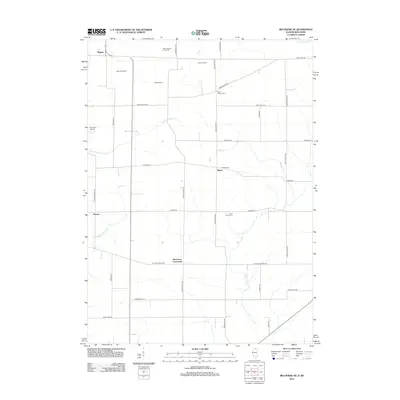
2012 Map of Belvidere NE
USGS Topo · Published 2012About this map
Beaverton Crossroads and the nearby village of Blaine anchor this rural landscape in Boone County, where the topography is defined by the winding paths of N Kinnikinnick Cr and Beaver Cr. In the early 21st century, this area remains a mix of established family operations like Hillcrest Farm and Johnson Farms alongside small local aviation facilities such as Nemec Airport and Lee Creek Airport.
Find a feature on this map
38 named features on this map. Tap any name to fly to it.
Don’t see what you’re looking for? This feature index may not catch every label — zoom into the map to look around manually.
Map Details
Editions of this 2012 Belvidere NE Map
This is the sole edition of this map. No revisions or reprints were ever made.
Other maps of this area

1893 · Delavan
USGS Topo · 1:62,500

1893 · Shopiere
USGS Topo · 1:62,500

1918 · Belvidere
USGS Topo · 1:62,500

1932 · Harvard
USGS Topo · 1:48,000

1937 · Harvard
USGS Topo · 1:62,500

1944 · Belvidere
USGS Topo · 1:62,500

1954 · Rockford
USGS Topo · 1:250,000

1955 · Rockford
USGS Topo · 1:250,000

1958 · Rockford
USGS Topo · 1:250,000
1960 · Delavan
USGS Topo · 1:62,500