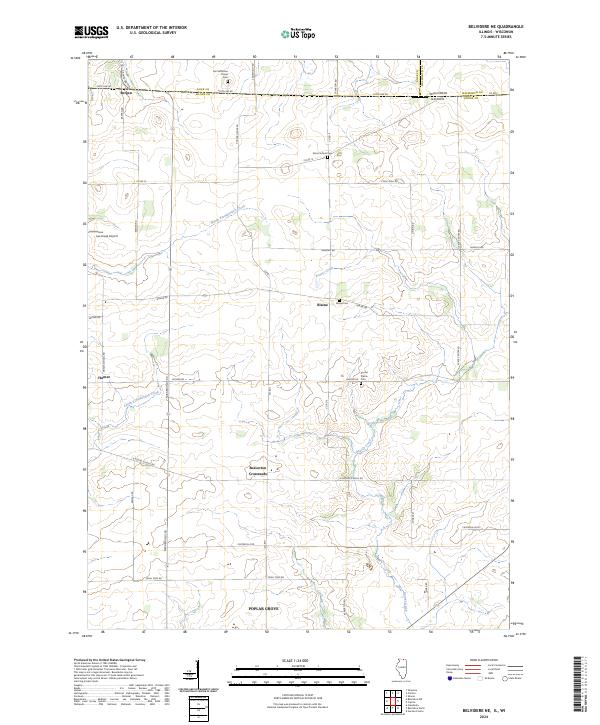
2024 Map of Belvidere NE
USGS Topo · Published 2024About this map
The borderlands between Illinois and Wisconsin are defined here by a network of agricultural roads and glacial prairies. This 2024 survey documents the landscape around Poplar Grove and the historical hamlet of Beaverton Crossroads. The terrain is marked by broad open areas such as East Jefferson Prairie and Round Prairie, which have long anchored the local farming community. Waterways including Beaver Creek and both the North Kinnikinnick Creek and South Kinnikinnick Creek weave through the township, influencing the placement of early settlements like Blaine and Hunter. For family historians, the map is a vital resource, accurately locating generational burial sites such as East Jefferson Prairie Cem, Blaine Cem, and the Round Prairie Cem. Small-scale aviation is represented by Lee Creek Airport, while the proximity to the state line is reinforced by State Line Rd and the crossing into Bergen at the northern edge.
Find a feature on this map
48 named features on this map. Tap any name to fly to it.
Don’t see what you’re looking for? This feature index may not catch every label — zoom into the map to look around manually.
Map Details
Editions of this 2024 Belvidere NE Map
This is the sole edition of this map. No revisions or reprints were ever made.
Other maps of this area

1893 · Delavan
USGS Topo · 1:62,500

1893 · Shopiere
USGS Topo · 1:62,500

1918 · Belvidere
USGS Topo · 1:62,500

1932 · Harvard
USGS Topo · 1:48,000

1937 · Harvard
USGS Topo · 1:62,500

1944 · Belvidere
USGS Topo · 1:62,500

1954 · Rockford
USGS Topo · 1:250,000

1955 · Rockford
USGS Topo · 1:250,000

1958 · Rockford
USGS Topo · 1:250,000
1960 · Delavan
USGS Topo · 1:62,500