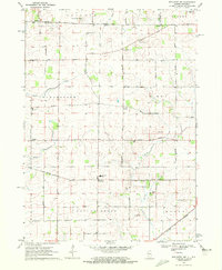
1970 Map of Belvidere NE
USGS Topo · Published 1972About this map
The Wisconsin Illinois State Line Road defines the northern edge of this agricultural region, where the prairie transitions into the drainage basins of the Kinnikinnick Creek and Beaver Creek. Small crossroad settlements like Bergen, Blaine, and Hunter anchor the rural landscape, serving as historical touchpoints for the townships of Manchester, Leroy, and Boone. The map highlights a community deeply rooted in its local institutions, evidenced by the clustered Jefferson Prairie Ch and its accompanying East Jefferson Prairie Cem near the state boundary.
Find a feature on this map
40 named features on this map. Tap any name to fly to it.
Don’t see what you’re looking for? This feature index may not catch every label — zoom into the map to look around manually.
Map Details
Editions of this 1970 Belvidere NE Map
This is the sole edition of this map. No revisions or reprints were ever made.
Other maps of this area

1893 · Delavan
USGS Topo · 1:62,500

1893 · Shopiere
USGS Topo · 1:62,500

1918 · Belvidere
USGS Topo · 1:62,500

1932 · Harvard
USGS Topo · 1:48,000

1937 · Harvard
USGS Topo · 1:62,500

1944 · Belvidere
USGS Topo · 1:62,500

1954 · Rockford
USGS Topo · 1:250,000

1955 · Rockford
USGS Topo · 1:250,000

1958 · Rockford
USGS Topo · 1:250,000
1960 · Delavan
USGS Topo · 1:62,500