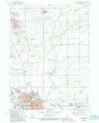
1970 Map of Belvidere North
USGS Topo · Published 1993About this map
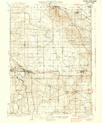
Belvidere serves as the industrial and civic anchor of this northern Illinois landscape, where the Kishwaukee River cuts through the southern reaches of Boone County. The town's grid is dense with essential institutions including the Courthouse, St Joseph Hospital, and several local schools like Logan Sch. Outside the urban center, the landscape transitions into agricultural plots and small clusters such as Poplar Grove and the crossroads at Russellville. Transportation defines the area's development, marked by the Chicago and North Western rail line and the presence of the Belvidere Limited Airport.
Find a feature on this map
78 named features on this map. Tap any name to fly to it.
Don’t see what you’re looking for? This feature index may not catch every label — zoom into the map to look around manually.
Map Details
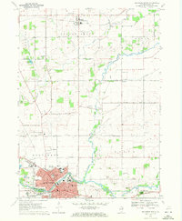
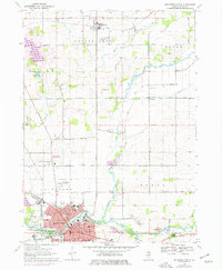
Editions of this 1970 Belvidere North Map
3 editions found
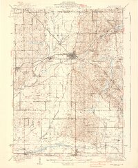
Other maps of this area

1918 · Belvidere
USGS Topo · 1:62,500

1918 · Kirkland
USGS Topo · 1:62,500

1932 · Harvard
USGS Topo · 1:48,000
1937 · Harvard
USGS Topo · 1:62,500
1938 · Genoa
USGS Topo · 1:62,500

1944 · Belvidere
USGS Topo · 1:62,500

1954 · Rockford
USGS Topo · 1:250,000

1955 · Rockford
USGS Topo · 1:250,000

1958 · Rockford
USGS Topo · 1:250,000

1963 · Rockford
USGS Topo · 1:250,000
Featured Places
- Belvidere, Belvidere Township
- Poplar Grove, IL
- Timberlane, IL
- Belvidere Township, IL
- Caledonia Township, IL