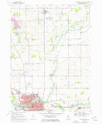
1970 Map of Belvidere North
USGS Topo · Published 1977About this map
Belvidere serves as the industrial and civic anchor of this 1970 Boone County survey, situated along the banks of the Kishwaukee River. The city’s dense street grid is marked by institutional landmarks including the county Courthouse, St Joseph Hospital, and several schools like Logan Sch and St James Sch. Just north of the urban center, the landscape transitions into a well-defined agricultural pattern bisected by the Chicago and North Western railroad.
Find a feature on this map
60 named features on this map. Tap any name to fly to it.
Don’t see what you’re looking for? This feature index may not catch every label — zoom into the map to look around manually.
Map Details
Editions of this 1970 Belvidere North Map
3 editions found
Other maps of this area

1918 · Belvidere
USGS Topo · 1:62,500

1918 · Kirkland
USGS Topo · 1:62,500

1932 · Harvard
USGS Topo · 1:48,000

1937 · Harvard
USGS Topo · 1:62,500

1938 · Genoa
USGS Topo · 1:62,500

1944 · Belvidere
USGS Topo · 1:62,500

1954 · Rockford
USGS Topo · 1:250,000

1955 · Rockford
USGS Topo · 1:250,000

1958 · Rockford
USGS Topo · 1:250,000

1963 · Rockford
USGS Topo · 1:250,000