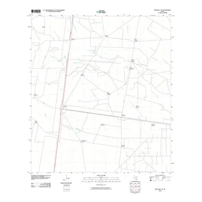
2010 Map of Ben Bolt SE
USGS Topo · Published 2010About this map
Ben Bolt Oil Field and the King Ranch Borregos Oil Field define the industrial footprint of this South Texas landscape in Jim Wells County. The terrain is a network of ranching and energy infrastructure, where numerous named water-pumping stations like El Parr Windmill, Hormigas Windmill, and the Olmo Grande Windmill serve the local cattle operations. Water features such as Trinidad Lake, Chivos Lake, and Olmo Lake are scattered across the drainage basins of Santa Gertrudis Creek and San Andreas Creek. A legacy of large-scale landholding is evident through the Los Machos Ranch and features associated with the famous King Ranch, including King Ranch Dam Number 4. Transportation and logistics are anchored by the Kleberg County Airport and the intersection of secondary routes like FM 735 and FM 2295.
Find a feature on this map
29 named features on this map. Tap any name to fly to it.
Don’t see what you’re looking for? This feature index may not catch every label — zoom into the map to look around manually.
Map Details
Editions of this 2010 Ben Bolt SE Map
This is the sole edition of this map. No revisions or reprints were ever made.
Other maps of this area

1917 · Ben Bolt
USGS Topo · 1:62,500

1921 · Falfurrias
USGS Topo · 1:125,000

1928 · Sarita
USGS Topo · 1:125,000

1950 · Corpus Christi
USGS Topo · 1:250,000

1954 · Kingsville
USGS Topo · 1:62,500

1954 · Riviera
USGS Topo · 1:62,500

1956 · Corpus Christi
USGS Topo · 1:250,000

1956 · Laredo
USGS Topo · 1:250,000

1960 · Corpus Christi
USGS Topo · 1:250,000

1963 · Ben Bolt SE
USGS Topo · 1:24,000