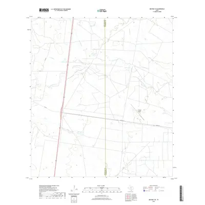
2019 Map of Ben Bolt SE
USGS Topo · Published 2019About this map
Trinidad Lake and Las Conchas Lake are focal points of this South Texas landscape where the boundaries of Jim Wells and Kleberg counties meet. The area is characterized by an intricate network of intermittent drainages, including Santa Gertrudis Cr and San Andreas Cr, which feed into various small lakes like Patricio Lake and Chivos Lake. This 2019 survey documents the rural infrastructure of the region, anchored by the Kleberg County Airport and a grid of secondary roads such as Farm Rd 141 and FM 2295. The terrain reflects the transition from open grazing land to managed aviation and transport corridors, with Olmo Lake sitting near the southern county line, illustrating the importance of water catchment in this arid environment.
Find a feature on this map
15 named features on this map. Tap any name to fly to it.
Don’t see what you’re looking for? This feature index may not catch every label — zoom into the map to look around manually.
Map Details
Editions of this 2019 Ben Bolt SE Map
This is the sole edition of this map. No revisions or reprints were ever made.
Other maps of this area

1917 · Ben Bolt
USGS Topo · 1:62,500

1921 · Falfurrias
USGS Topo · 1:125,000

1928 · Sarita
USGS Topo · 1:125,000

1950 · Corpus Christi
USGS Topo · 1:250,000

1954 · Kingsville
USGS Topo · 1:62,500

1954 · Riviera
USGS Topo · 1:62,500

1956 · Corpus Christi
USGS Topo · 1:250,000

1956 · Laredo
USGS Topo · 1:250,000

1960 · Corpus Christi
USGS Topo · 1:250,000

1963 · Ben Bolt SE
USGS Topo · 1:24,000