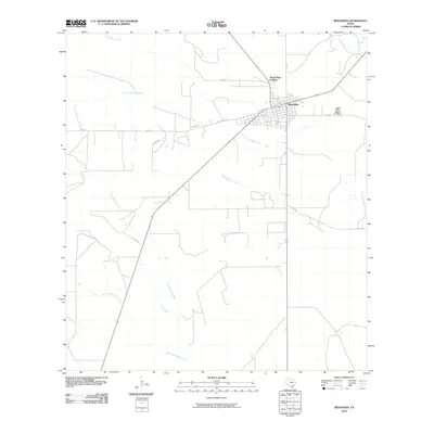
2010 Map of Benavides
USGS Topo · Published 2010About this map
Benavides serves as the primary hub in this South Texas landscape, characterized by a complex network of ephemeral waterways. The town's grid is situated near the confluence of Las Animas Creek and Santa Gertrudis Creek, reflecting the importance of drainage in this semi-arid region. To the north, the residential cluster of Mario Olga Colonia extends the settlement footprint along the secondary road corridors. The surrounding terrain is defined by low-lying drainages including Agua Poquita Creek, Jaboncillos Creek, and North Concepcion Creek. This 2010 survey illustrates the modern road network, where state routes like FM 2295 and county roads such as Co RD 306 provide access across the brushland. Local historians can observe how the community of Benavides remained centered on its original townsite while smaller developments emerged on its periphery.
Find a feature on this map
14 named features on this map. Tap any name to fly to it.
Don’t see what you’re looking for? This feature index may not catch every label — zoom into the map to look around manually.
Map Details
Editions of this 2010 Benavides Map
This is the sole edition of this map. No revisions or reprints were ever made.
Other maps of this area

1921 · Falfurrias
USGS Topo · 1:125,000

1956 · Benavides
USGS Topo · 1:62,500

1956 · Laredo
USGS Topo · 1:250,000

1967 · Parrilla Creek SE
USGS Topo · 1:24,000

1967 · Realitos
USGS Topo · 1:24,000

1968 · Concepcion
USGS Topo · 1:24,000

1968 · Benavides NW
USGS Topo · 1:24,000

1968 · San Jose
USGS Topo · 1:24,000

1968 · Benavides
USGS Topo · 1:24,000

1968 · Concepcion NW
USGS Topo · 1:24,000