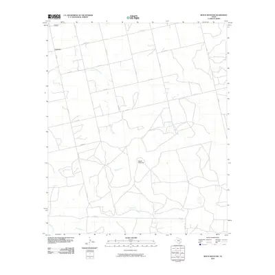
2010 Map of Bench Mountain
USGS Topo · Published 2010About this map
The small community of Champion serves as a primary reference point in this corner of Nolan County, where the landscape is defined by the high ground of Bench Mountain and a network of seasonal watercourses. The drainage patterns across this ranching country are established by the South Fork Champion Creek, Seale Creek, and Plum Creek, which carve gentle paths through the terrain. A modest local road system, including FM 1230 and FM 608, connects the scattered homesteads and property lines that stretch between the hills and the creek beds.
Find a feature on this map
19 named features on this map. Tap any name to fly to it.
Don’t see what you’re looking for? This feature index may not catch every label — zoom into the map to look around manually.
Map Details
Editions of this 2010 Bench Mountain Map
This is the sole edition of this map. No revisions or reprints were ever made.
Other maps of this area

1893 · Sweetwater
USGS Topo · 1:125,000

1954 · Big Spring
USGS Topo · 1:250,000

1958 · Big Spring
USGS Topo · 1:250,000

1959 · Dam Draw
USGS Topo · 1:24,000

1969 · Baumann School
USGS Topo · 1:24,000

1969 · Bench Mountain
USGS Topo · 1:24,000

1969 · Loraine
USGS Topo · 1:24,000

1969 · Maryneal
USGS Topo · 1:24,000
1969 · Dew Drop Creek
USGS Topo · 1:24,000

1969 · Roscoe
USGS Topo · 1:24,000