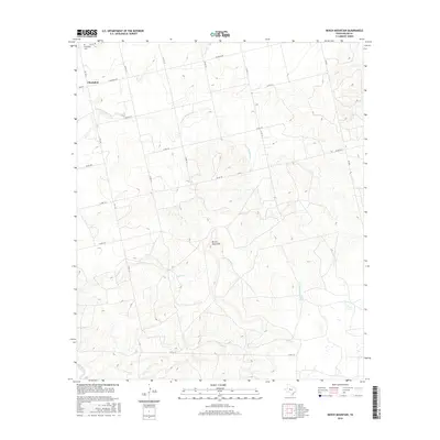
2016 Map of Bench Mountain
USGS Topo · Published 2016About this map
Champion and its immediate surroundings are defined by a network of rural county roads and local drainages in this 2016 survey of Nolan County. The settlement, situated in the northwest corner, is anchored by the Champion Cem, a vital site for local genealogical research. The topography is dominated by the prominent rise of Bench Mountain, which serves as a central landmark amidst the dissected plateaus of West Texas.
Find a feature on this map
22 named features on this map. Tap any name to fly to it.
Don’t see what you’re looking for? This feature index may not catch every label — zoom into the map to look around manually.
Map Details
Editions of this 2016 Bench Mountain Map
This is the sole edition of this map. No revisions or reprints were ever made.
Other maps of this area

1893 · Sweetwater
USGS Topo · 1:125,000

1954 · Big Spring
USGS Topo · 1:250,000

1958 · Big Spring
USGS Topo · 1:250,000

1959 · Dam Draw
USGS Topo · 1:24,000

1969 · Baumann School
USGS Topo · 1:24,000

1969 · Bench Mountain
USGS Topo · 1:24,000

1969 · Loraine
USGS Topo · 1:24,000

1969 · Maryneal
USGS Topo · 1:24,000
1969 · Dew Drop Creek
USGS Topo · 1:24,000

1969 · Roscoe
USGS Topo · 1:24,000