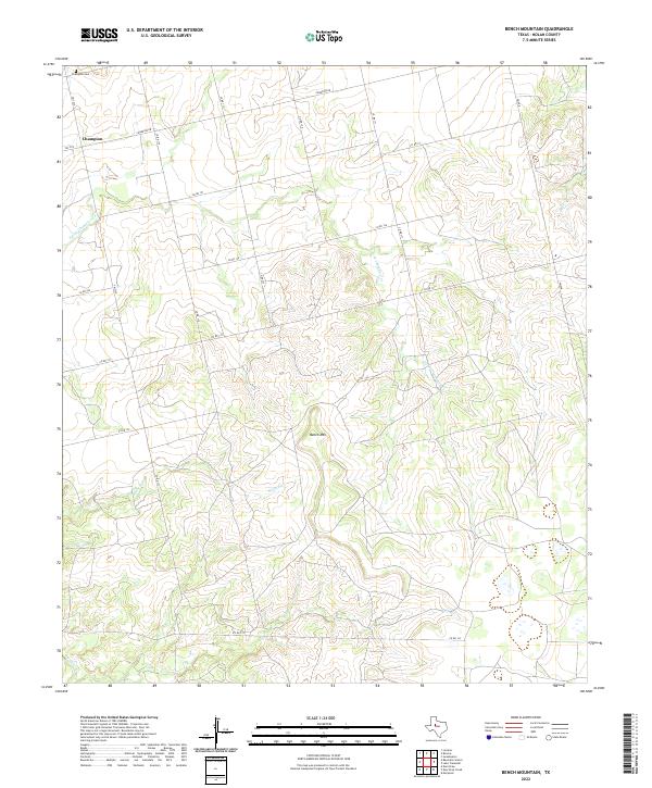
2022 Map of Bench Mountain
USGS Topo · Published 2022About this map
Champion and its surrounding ranchlands characterize this portion of Nolan County, where the topography is defined by the prominent Bench Mtn. The landscape is etched by a network of seasonal drainage systems, including S Fork Champion Cr and Barnett Cr, which flow through the dissected terrain. A grid of rural routes such as Champion Rd and Co Rd 151 provides access to the scattered homesteads and agricultural operations that have long occupied this region.
Find a feature on this map
21 named features on this map. Tap any name to fly to it.
Don’t see what you’re looking for? This feature index may not catch every label — zoom into the map to look around manually.
Map Details
Editions of this 2022 Bench Mountain Map
This is the sole edition of this map. No revisions or reprints were ever made.
Other maps of this area

1893 · Sweetwater
USGS Topo · 1:125,000

1954 · Big Spring
USGS Topo · 1:250,000

1958 · Big Spring
USGS Topo · 1:250,000

1959 · Dam Draw
USGS Topo · 1:24,000

1969 · Baumann School
USGS Topo · 1:24,000

1969 · Bench Mountain
USGS Topo · 1:24,000

1969 · Loraine
USGS Topo · 1:24,000

1969 · Maryneal
USGS Topo · 1:24,000
1969 · Dew Drop Creek
USGS Topo · 1:24,000

1969 · Roscoe
USGS Topo · 1:24,000