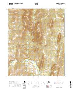
2017 Map of Bendeleben A-1 SE
USGS Topo · Published 2017About this map
The Tubutulik River defines the drainage of this interior portion of the Seward Peninsula, recorded by the U.S. Geological Survey in 2017. This landscape in the Nome Census Area is characterized by a dense network of watercourses including Admiral Cr, Salmon Cr, and Chukaik Cr. The drainage patterns shown here, from the northern headwaters of June Cr to the southern reaches of Rock Cr and Lost Cr, illustrate the complex hydrology of the Alaskan wilderness. Surveyed without any named roads or settlements, the map focuses on topographical precision and the naming of tributary streams like Grouse Cr and Boulder Cr, which have long served as primary reference points for navigation and exploration in this unpopulated subarctic region.
Find a feature on this map
15 named features on this map. Tap any name to fly to it.
Don’t see what you’re looking for? This feature index may not catch every label — zoom into the map to look around manually.
Map Details
Editions of this 2017 Bendeleben A-1 SE Map
This is the sole edition of this map. No revisions or reprints were ever made.
Other maps of this area

1948 · Norton Bay
USGS Topo · 1:250,000

1950 · Bendeleben A-1
USGS Topo · 1:63,360

1950 · Norton Bay D-6
USGS Topo · 1:63,360

1950 · Bendeleben
USGS Topo · 1:250,000

1950 · Solomon D-1
USGS Topo · 1:63,360

1950 · Solomon
USGS Topo · 1:250,000

1950 · Candle A-6
USGS Topo · 1:63,360

1951 · Candle
USGS Topo · 1:250,000

1951 · Bendeleben
USGS Topo · 1:250,000

1951 · Solomon
USGS Topo · 1:250,000