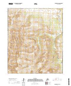
2017 Map of Bendeleben A-1 SW
USGS Topo · Published 2017About this map
The Darby Mountains anchor the central topography of this landscape on the Seward Peninsula, where a complex network of streams and drainages defines the area's character. In the northeast, the dramatic nomenclature of Death Valley sits near the headwaters of the Tubutulik River, which flows southward along the eastern edge of the survey. The drainage patterns are intricate, with Big Cr cutting through the southern half of the quadrangle while smaller tributaries like Jones Pup Cr, Otter Cr, and Deacon Cr feed the northern watersheds. The area is marked by its lack of established settlements, reflecting a wilderness state defined by the intersection of mountain ridges and creek beds like Caribou Cr and Trail Cr. This 2017 data reflects the remote, undeveloped nature of the Nome Census Area, where the terrain is the primary feature of record.
Find a feature on this map
16 named features on this map. Tap any name to fly to it.
Don’t see what you’re looking for? This feature index may not catch every label — zoom into the map to look around manually.
Map Details
Editions of this 2017 Bendeleben A-1 SW Map
This is the sole edition of this map. No revisions or reprints were ever made.
Other maps of this area

1950 · Bendeleben A-2
USGS Topo · 1:63,360

1950 · Bendeleben A-1
USGS Topo · 1:63,360

1950 · Solomon D-2
USGS Topo · 1:63,360

1950 · Bendeleben
USGS Topo · 1:250,000

1950 · Solomon D-1
USGS Topo · 1:63,360

1950 · Solomon
USGS Topo · 1:250,000

1951 · Bendeleben
USGS Topo · 1:250,000

1951 · Solomon
USGS Topo · 1:250,000

1964 · Bendeleben
USGS Topo · 1:250,000
2014 · Solomon D-1 NE
USGS Topo · 1:25,000