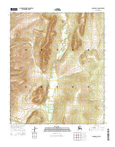
2014 Map of Solomon D-1 NE
USGS Topo · Published 2014About this map
The Tubutulik River defines the central corridor of this interior landscape on the Seward Peninsula, winding through a series of valleys as captured in this 2014 survey. Several drainage systems contribute to the river's flow, including Chukajak Cr from the east and the waters of Vulcan Cr and Falcon Cr from the western elevations. The map reveals a wild, unpopulated territory where the land is strictly organized by the Public Land Survey System, as evidenced by the township and range boundaries of t6s r18w and t7s r17w. Farther south, the confluence of Clear Cr highlights the intricate network of seasonal and perennial streams that drain the high ground in this part of Alaska. This document serves as a detailed record of the hydrography and elevation before any modern infrastructure altered the natural course of these waterways.
Find a feature on this map
10 named features on this map. Tap any name to fly to it.
Don’t see what you’re looking for? This feature index may not catch every label — zoom into the map to look around manually.
Map Details
Editions of this 2014 Solomon D-1 NE Map
This is the sole edition of this map. No revisions or reprints were ever made.
Other maps of this area

1948 · Norton Bay
USGS Topo · 1:250,000

1950 · Bendeleben A-1
USGS Topo · 1:63,360

1950 · Norton Bay D-6
USGS Topo · 1:63,360

1950 · Bendeleben
USGS Topo · 1:250,000

1950 · Solomon D-1
USGS Topo · 1:63,360

1950 · Solomon
USGS Topo · 1:250,000

1950 · Candle A-6
USGS Topo · 1:63,360

1951 · Candle
USGS Topo · 1:250,000

1951 · Bendeleben
USGS Topo · 1:250,000

1951 · Solomon
USGS Topo · 1:250,000