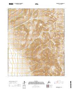
2017 Map of Bendeleben A-2 SE
USGS Topo · Published 2017About this map
The high peaks of the Darby Mountains define this section of the Seward Peninsula, captured here in a 2017 survey by the U.S. Geological Survey. The landscape is dominated by complex drainage systems, notably the branching headwaters of Mosquito Creek. This network includes the North Fork Mosquito Creek and South Fork Mosquito Creek, which carve deep valleys around the prominent Omilak Mountain. In the northeastern corner, Trail Creek flows through high-elevation terrain, illustrating the hydrologic patterns of the Nome Census Area. This map provides a modern scientific record of topographic contours and hydrography within the T4S through T6S townships, showing a region largely shaped by its natural watercourses and mountain ridges.
Find a feature on this map
12 named features on this map. Tap any name to fly to it.
Don’t see what you’re looking for? This feature index may not catch every label — zoom into the map to look around manually.
Map Details
Editions of this 2017 Bendeleben A-2 SE Map
This is the sole edition of this map. No revisions or reprints were ever made.
Other maps of this area

1950 · Bendeleben A-2
USGS Topo · 1:63,360

1950 · Bendeleben A-1
USGS Topo · 1:63,360

1950 · Solomon D-2
USGS Topo · 1:63,360

1950 · Bendeleben
USGS Topo · 1:250,000

1950 · Solomon D-1
USGS Topo · 1:63,360

1950 · Solomon
USGS Topo · 1:250,000

1951 · Bendeleben
USGS Topo · 1:250,000

1951 · Solomon
USGS Topo · 1:250,000

1964 · Bendeleben
USGS Topo · 1:250,000
2014 · Solomon D-1 NW
USGS Topo · 1:25,000