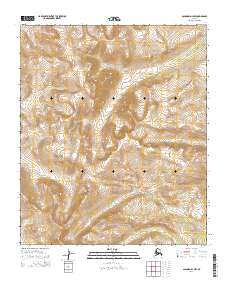
2014 Map of Solomon D-1 NW
USGS Topo · Published 2014About this map
Darby Mountains rise through this section of the Seward Peninsula, defining a landscape shaped by high-elevation drainages and seasonal watercourses. This 2014 survey captures the untouched character of the Alaskan interior east of Nome, where the terrain is marked by significant topographical relief and the headwaters of several remote creeks. Steep ridgelines separate the valleys of Omilak Cr and Rock Cr, while the southern reaches of the map are defined by the winding path of Dry Canyon Cr. To the east, Vulcan Cr cuts through the high country, illustrating the complex hydrology of the range. The map provides a precise record of these natural landmarks and the Public Land Survey System grid lines that segment this vast, uninhabited stretch of the Alaskan wilderness.
Find a feature on this map
9 named features on this map. Tap any name to fly to it.
Don’t see what you’re looking for? This feature index may not catch every label — zoom into the map to look around manually.
Map Details
Editions of this 2014 Solomon D-1 NW Map
This is the sole edition of this map. No revisions or reprints were ever made.
Other maps of this area

1950 · Bendeleben A-2
USGS Topo · 1:63,360

1950 · Bendeleben A-1
USGS Topo · 1:63,360

1950 · Solomon D-2
USGS Topo · 1:63,360

1950 · Bendeleben
USGS Topo · 1:250,000

1950 · Solomon D-1
USGS Topo · 1:63,360

1950 · Solomon
USGS Topo · 1:250,000

1951 · Bendeleben
USGS Topo · 1:250,000

1951 · Solomon
USGS Topo · 1:250,000

1964 · Bendeleben
USGS Topo · 1:250,000
2014 · Solomon D-1 NE
USGS Topo · 1:25,000